
Ipswich Marina to Shotley Ferry
Walk 9: Monday 5th July 2021
On this page
Walk
Distance: 12 miles
We stay on the Stour & Orwell walk, this time following the right bank of the Orwell with occasional diversions into the surrounding countryside.
To all Walkers
There are two official meeting locations per day; at the start and near the mid-point. If you only wish to walk your one-mile stretch and join the walking party as it comes through your section, you can specify to meet ‘at my mile’ on the booking form (which should have been emailed to you already).
If you are meeting ‘at my mile’, please understand it is difficult for us to specify the exact time the main walking party will arrive. To help you estimate this, use the scheduled times below and add 30 mins per mile to get to your mile. We are using a walking speed of 2 miles an hour as a guide.
If you don’t receive any emails about the walks, please check your spam folder or email info@beachofdreams.co.uk
Schedule
Please arrive 20 minutes beforehand.
Start point 10AM: (Miles 121 – 126) Coffee Cat, Ipswich Waterfront, 9 Neptune Quay, Ipswich IP4 1QJ
Mid point 1:00PM: (Miles 127 – 132) Ivy Cottage, Pinmill Rd, Chelmondiston, Ipswich IP9 1JN
End point 3:30PM: Shotley Marina, Shotley Gate, Ipswich IP9 1QJ
![]()

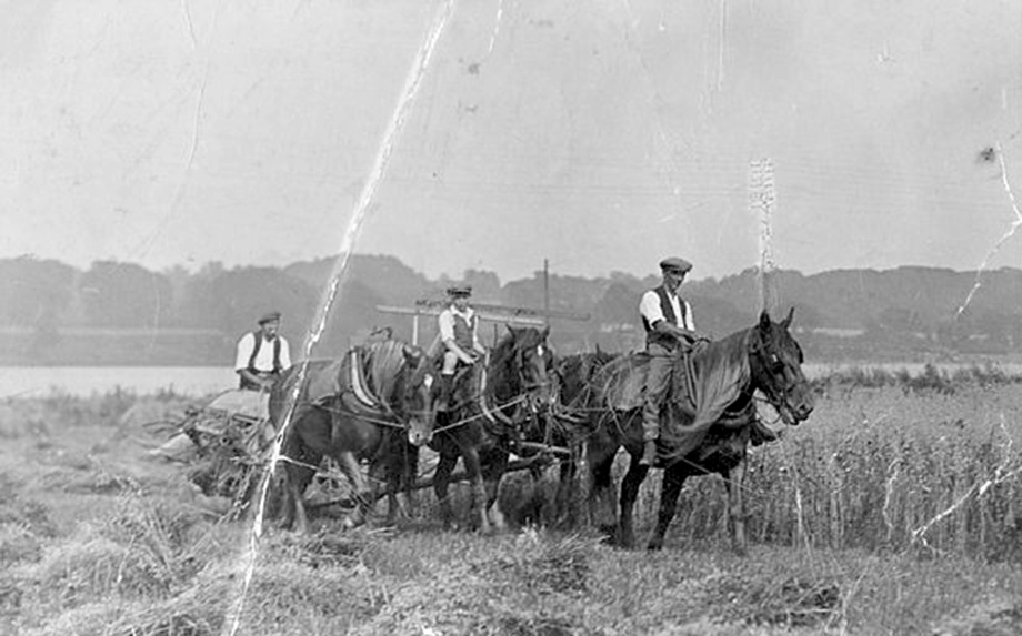
Route: Walk 9
Finding the Gems
See all the mapped miles on the Beach of Dreams Storymap, find a selection below.
Ipswich Marina to Shotley Miles
-
Mile 129
River Orwell
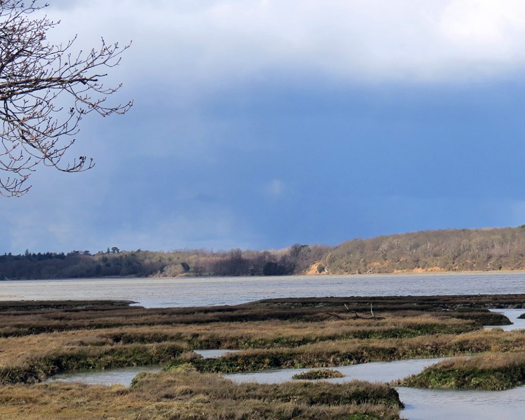
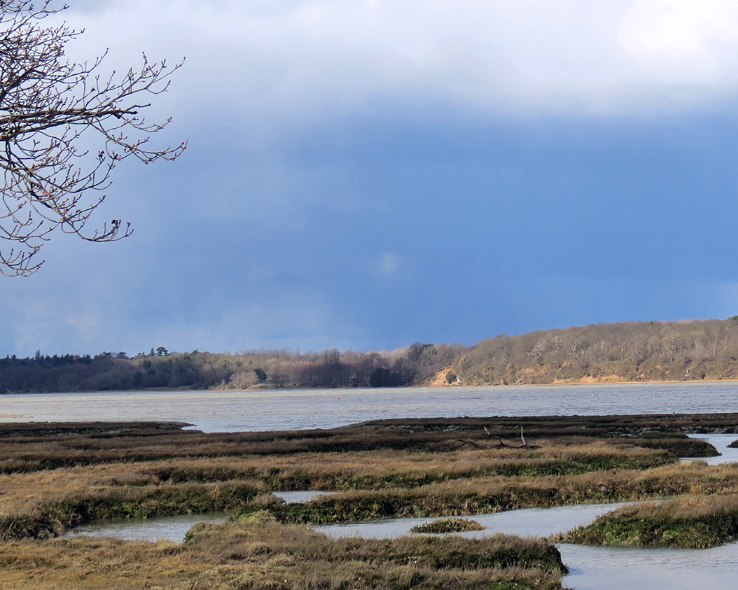
It was a very blustery day last week when I walked again along the shore from Pin Mill. I was particularly struck by this brooding, leaden sky and the ‘danger’ it foretold of rain and cold to come. It seemed like a strong portent and mirrored the anxiety within me: the pandemic has caused such a deep-seated unease within us all and the sky appeared to mirror that disquiet. Looking again at the view, my spirits lifted as I concentrated on the strength of the light on the opposite shore and on the buds reaching forward from the oak tree. The rain didn’t come.
I love the strength and width of this river. I have so many memories of watching my husband sail up and down with one of our children as I entertained the youngest from the shore. He was always so incredibly delighted to spot our dinghy so my lasting memory of this stretch of water, and the footpath alongside it, is his palpable excitement and energy.
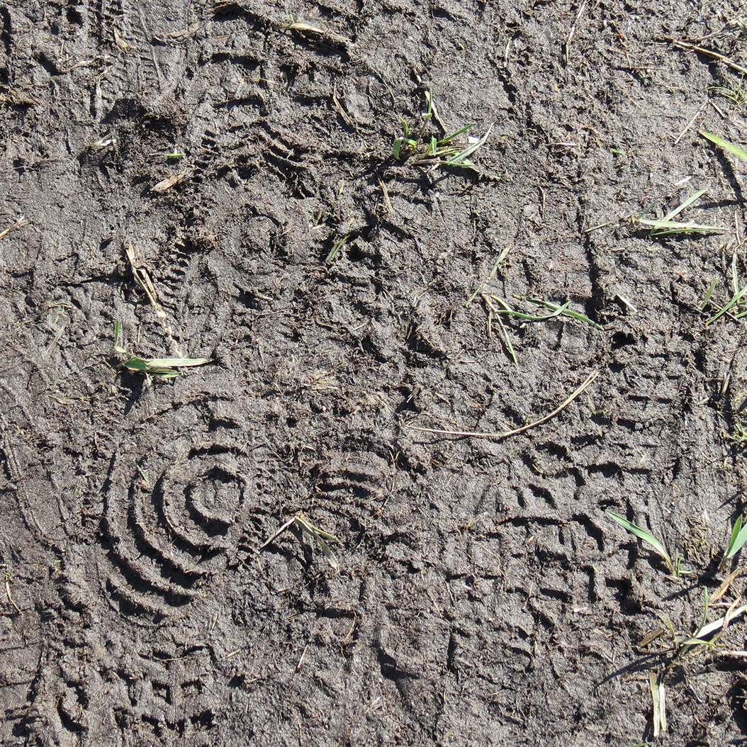
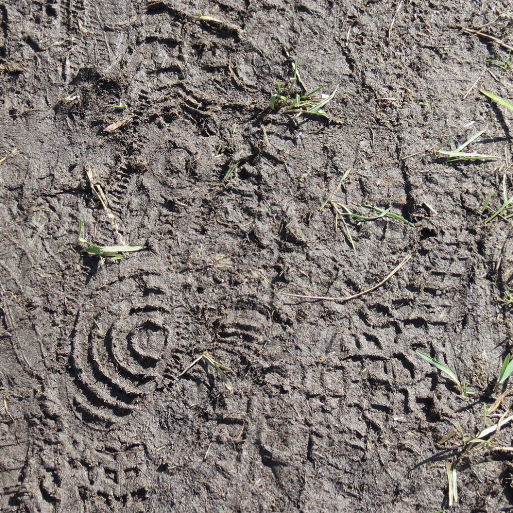
Footprints in the mud are a literal indicator of the passage of humans. Again, I see a duality beyond the contrast of the green grass and brown mud that I find interesting. On the one hand, people are walking to take exercise and enjoy the views - as I was. The different prints reflect our individuality since no two are completely alike. The roundels, incompletely formed, are striking and pose questions about the uneven tread of the person who walked ahead. We can’t follow the clues suggested by the prints, but they excite the imagination. On the other hand, the footprints made me think about wider questions to do with the negative impact we are having on the planet. The grass is tenacious but beaten down, squashed and distorted: as it tries to push up, another step, my own, beats it back down.
by Kate Charlton-Jones
MILE 124
-
Mile 124
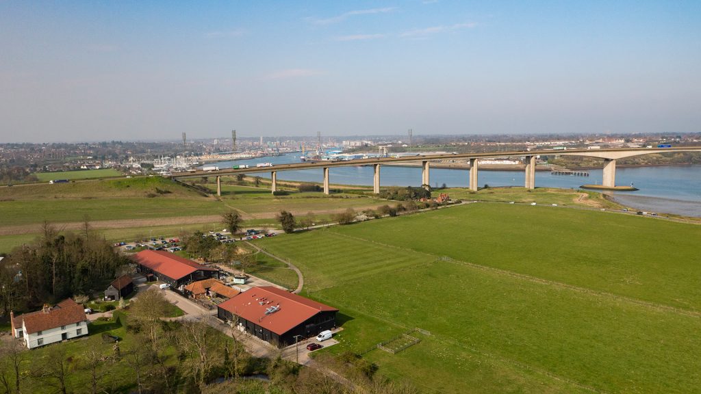
The Strand
The Strand, following the Orwell foreshore between Wherstead and Freston, is named with reverence. It has seen much change over the centuries in heritage and modernity, rural and urban, farmland and navigation. Its setting is framed by the iconic Orwell Bridge which is much more than just a lump of concrete infrastructure.
Our family has farmed along the Strand for generations and before that operated a fleet of east coast barges trading from the port of Ipswich. We have also seen much change and more recently we established the Suffolk Food Hall to provide enjoyable access to the wonderful products of our region. Farming practices have responded to such opportunities too, and we are delighted to see traditional extensive systems becoming more applicable again. In particular, we have grassed over intensive arable fields and reverted to grazing Red Poll cattle on paddocks along the Strand.
The epochal bridge divides the hustle of the port from an awe-inspiring vista down the River Orwell. It is a gateway to the Suffolk Coast & Heaths AONB and we are privileged that more of our farm has been included in a boundary extension to this national landscape designation. Whilst the bridge is striking within the landscape, many marvel at its beauty. A sleek piece of engineering, giving rise to questions around how and when.
Another contribution to our community is by answering such questions, through the Suffolk Food Hall team, with infographic boards, recreational access to the Strand and extolling the best practices of land management. Agri-environment schemes we run along the Strand, up Freston Brook and in the connected ancient woodlands, all benefit the wildlife in this foreshore-farmland niche. Despite the pressures of change, this mile brings a smile, and our Strand is a unique thread on the east coast.
By Suffolk Food Hall
Story Map Submit Content All Walks Walk Guidelines Beach of Dreams Main Page FAQs