
Bradwell Waterside to Burnham-on-Crouch Quay
Walk 21: Sunday 18th July 2021
On this page
Walk
Distance: 17 miles
One of the most remarkable coastal walks in England. Seventeen miles without habitation, save for the religious community beside the 7th century St Peter’s Chapel.
To all Walkers
There are two official meeting locations per day; at the start and near the mid-point. If you only wish to walk your one-mile stretch and join the walking party as it comes through your section, you can specify to meet ‘at my mile’ on the booking form (which should have been emailed to you already).
If you are meeting ‘at my mile’, please understand it is difficult for us to specify the exact time the main walking party will arrive. To help you estimate this, use the scheduled times below and add 30 mins per mile to get to your mile. We are using a walking speed of 2 miles an hour as a guide.
If you don’t receive any emails about the walks, please check your spam folder or email info@beachofdreams.co.uk
Schedule
Please be on time.
Please note that except for 4 miles in, there won’t be another point to leave the walk, this is due to the remote nature of the landscape. As with all the walks, but particularly this one, please make sure you are feeling well before starting and bring plenty of water and supplies.
- Start point 8.30AM (changed from 9am): (Miles 302 – 305) The Green Man, near Bradwell marina, Waterside Rd, Bradwell-on-Sea, Bradwell Waterside, Southminster CM0 7QX
- Mid point 11AM: (Miles 306 – 318) Option to join us for the first 4 miles and leave from this point – St Peters Chapel, – Directions The end of, E End Rd, Bradwell-on-Sea, DO CM0 7PW. (If arriving by car please park on the verge as directed by the signs and walk down to the chapel)
- End point 5 – 5:30PM: Burnham on Crouch Ferry landing opposite – The Anchor Burnham The Quay, Burnham-on-Crouch CM0 8AT
![]()
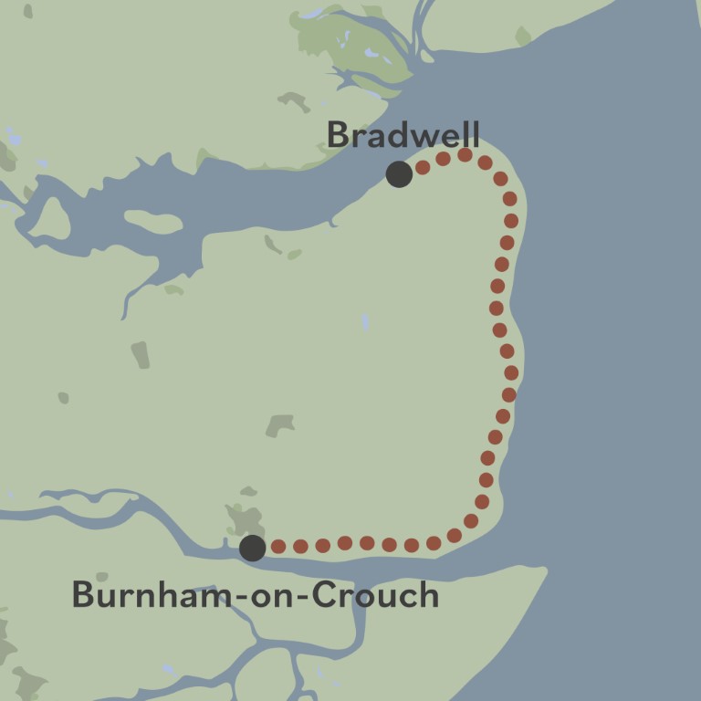
Route: Walk 21
Story Map Submit Content All Walks Walk Guidelines Beach of Dreams Main Page FAQs


